Satellite Monitoring and Imaging
From above the clouds to below the waves—our satellite-based systems reveal critical insights for environmental monitoring, security, and planning.
Satellite Monitoring with Purpose
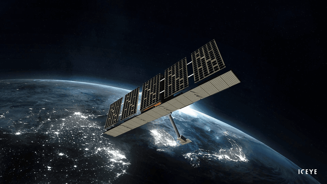
Arias Tech Solutions harnesses spaceborne sensors, including SAR (Synthetic Aperture Radar), optical, and multispectral imaging, to deliver high-resolution, all-weather, day-and-night monitoring of land and marine environments. These technologies are essential for tracking oil spills, mapping habitat changes, detecting vessel activity, and supporting biodiversity and climate initiatives. Integrated with our EMS, AI models, and ground-based systems, satellite imagery becomes an actionable layer for timely and informed decision-making across a wide range of sectors.

Applications of Satellite-Based Imaging
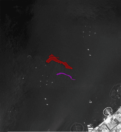
Multi-Sensor Satellite Observations for Environmental Change Detection and Resource Monitoring

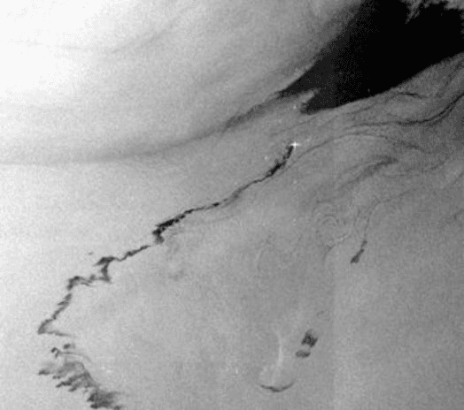
Detect Maritime Pollution
Detect oil spills and illegal discharges across open waters to support environmental compliance and response efforts.

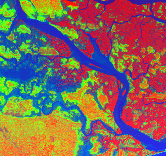
Land & Habitat Change
Track deforestation, mangrove degradation, and land desertification over time with multi-temporal satellite imagery.

Biodiversity & Biomass Mapping
Leverage multispectral data to monitor vegetation cover and marine productivity using NDVI and EVI.

Vessel Tracking and Threat Detection
Continuously monitor maritime traffic and detect vessels involved in illegal fishing, smuggling, and trafficking.

Core Imaging Technologies

High-Precision Imaging Tools to Monitor, Measure, and Understand a Changing Planet

Integrated Monitoring & Analysis
Bringing Space, Sea, and Sensors Together for Actionable Environmental Intelligence
AI-Enhanced Interpretation
Our proprietary models detect oil, classify land cover, and track vessel movement using SAR/optical data fusion.
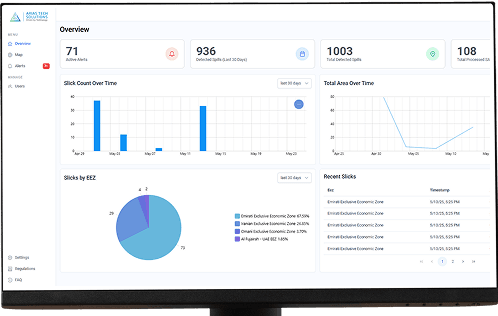
Real-Time Alerting
Satellite feeds are linked to Arias’ EMS platform for instant notifications of anomalies or mission-critical changes.
Multi-Platform Fusion
Imagery is synchronized with field sensors (buoys, CTDs), thermal cameras, and drone footage for full-scope situational awareness.
Satellite System Benefits
Reliable, Scalable, and Field-Tested Imaging Solutions for Real-World Impact
Persistent Monitoring
Coverage across remote and inaccessible areas without the need for ground infrastructure.
All-Weather Performance
SAR imaging ensures uninterrupted visibility in fog, storms, or nighttime operations.
Scalable & Cost-Effective
Choose from low-res wide coverage to ultra-high-res tasking based on mission needs and budget.
Proven Impact
Used in Arias Tech projects including BLU, Coastal Sentinel™, EcoMarine Sentinel™, and Artificial Reef tracking.
Our Partners
Trusted names we proudly collaborate with


Elevate Your Earth Intelligence
Leverage advanced satellite imaging to see beyond the visible and act before it’s too late.
Talk to an Expert